Like this? Follow me:
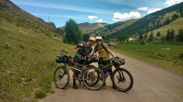
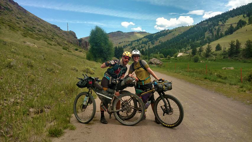
With another run of the Tour Divide this year, I’m reminded again of this awesome cross-country route and the many great memories I have on it.
The last time I was riding on the GDMBR was on my Tour of the Highest Hundred, where I rode up Marshall Pass after riding the 100 miles from Lake City to summit my first Sawatch of the trip: Mount Ouray.
The route itself was excellent, and provided a relatively quiet and mostly dirt route linking two disparate mountain ranges. The GDMBR barely gets into the San Juans, which is a real shame, as the San Juans are truly one of the crown jewels of Colorado. I’ll explain the route from Salida to Lake City, as this is where you’ll get on it via the GDMBR, then detour off towards Lake City. Once at Lake City, you’ll have to make a choice of where to go, as detouring back to the GDMBR is a trip in of itself and is also, sadly, all on pavement.
Here we go:
From Salida, follow the GDMBR up and over Marshall Pass. Essentially: follow Highway 285 to Marshall Pass Road. Marshall Pass is an interesting spot in long distance, self-powered travel: the Colorado Trail, Continental Divide Trail, and the Great Divide Mountain Bike Route all converge at this point. Camping opportunities abound, and one of the easiest routes to nearby Mt. Ouray can be accessed right at the summit of the pass.
If you want an even more interesting route up to Marshall Pass, take instead the Colorado Trail from the Blanks Cabin/Mt Shavano trailhead outside of Salida, and follow it south. This route is mostly singletrack, so be ready for the shift in riding style from the wide-open gravel roads of South Park to some amazing singletrack, including one of the steepest sections of the entire Colorado Trail. After riding the most awesome Monarch Crest, you’ll find yourself at the top of Marshall Pass. Tons of other options are available (take the first part of the Vapor Trail race route, perhaps?) – stop by a local bike shop while in town to get the details on trail conditions and options.
Once you’ve summited Marshall Pass, rocket down the other side towards Sargents, still following the GDMBR. The bizarre store that basically makes up, “Sargents” will have enough to resupply you for the entire rest of the way to Lake City, provided you hit it while it’s open.
Stay on the GDMBR by taking Highway 50 west until County Road 14PP. This relatively quiet stretch of gravel road can also get a bit toasty, as tree cover is a little sparse. CR 14PP will reach Highway 114 – turn left/east, then almost immediately turn right/south CR NN14. This is where our route diverges from the GDMBR. Turn southwest/right on George Bush Drive/Los Pinos Pass Road, before reaching Upper Dome Reservoir. You’re now on the right track towards Lake City!
The route here will feel familiar to what you would expect on the GDMBR: well-maintained gravel roads with light traffic in an idyllic, pastoral setting. This route is also the La Garita Wilderness detour of the Colorado Trail, so there’s a great chance you’ll bump into like-minded bikepackers. At the Cathedral townsite/junction, turn west onto Cebolla Creek Rd. (rather than North). Continue on Cebolla Creek Rd. and get ready for a massive, 2,000 foot climb up to Slumgullion Pass! At the terminus of Cebolla Creek, turn onto Highway 149 towards Lake City and “enjoy” losing that 2,000 feet of elevation you just climbed up!
Once in Lake City, check yourself into the Ravens Rest and say hello to Lucky for me. Plenty of things to do once in Lake City as a bikepacker. One obvious thing to do is to continue onto some of the best parts of the Colorado Trail all the way to Durango (don’t drop into Lake City from Slumgullion if you have enough food! Continue on HW 149 east). Riding up and over Cinnamon Pass to Silverton is also an option. The trailhead to Wetterhorn and Uncompaghre Peak can also easily be accessed by going up the track towards Henson mine site.
If you choose to continue onto the GDMBR, you can, by following HW 149 out of Lake City, then south east towards Creede, then Highway 160 east at South Fork. This is a long, but paved route – careful going from Creede to South Fork, as the road narrows considerably. Once in Alpine, take the highway all the way towards Del Norte and pick up then GDMBR there, or find CR 15 just north of town to get a dirt route for a little ways. CR 15 will hook up to the GDMBR just north of Del Norte, near the airport. This is a BIG detour for sure!

[…] GDMBR for hiking 14ers, and you don’t mind going even further off (that) route, see my post: GDMBR Detours: Lake City Linkup, which will take you far off the GDMBR and into the heart of the San […]
[…] GDMBR Detours: Lake City Linkup […]
[…] GDMBR Detours: Lake City Linkup […]